Drone Program
Brentwood Fire & Rescue UAS Program
Brentwood Fire & Rescue launched its Unmanned Aerial Systems (UAS) program in 2018 with one drone and a single FAA-licensed pilot. Today, the program has expanded to include three drones and ten licensed pilots. As one of the first municipal drone programs in the state, it was established to leverage emerging technology in support of public safety.
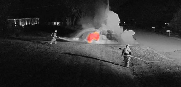
Though managed by the Fire Department, the UAS program serves multiple city departments. Drones provide rapid aerial overwatch during emergencies such as missing persons, vehicle crashes, and large public gatherings, offering critical visual data through real-time video and thermal imaging.
The drone team also supports non-emergency operations. Aerial mapping has assisted the Geographic Information Systems (GIS) Department, while post-flood imaging has helped the Planning and Codes Department document damage for FEMA claims. Drone footage has been used to monitor major construction projects, including Sunset Road and the new Brentwood Police Headquarters.
 Beyond Brentwood, the UAS team has responded to regional requests for mutual aid, including hazardous materials incidents and search and rescue efforts.
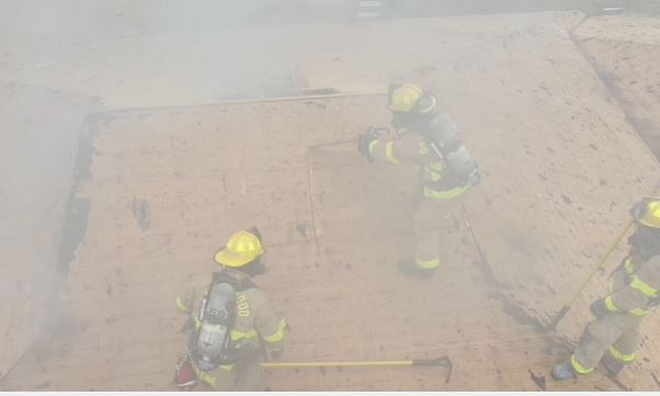
Drones are especially valuable during structure fires. Thermal imaging allows crews to identify hot spots and assess fire spread, even on steep or complex rooflines. This information is relayed in real time to the command post, improving safety and decision-making during fireground operations.

Looking ahead, Brentwood Fire & Rescue continues to explore advancements in drone technology, including a Drone as a First Responder (DFR) program, which could allow drones to autonomously deploy and arrive on scene ahead of ground crews, providing immediate aerial intelligence.
For more information about the UAS program, contact Lt. Ryan Prather at Brentwood Fire & Rescue.
Lt. Ryan Prather